
To grasp all the many facets of this complex matter I had to dummy it down, and then it became fairly straightforward, although I can’t say that I’ve mastered any of these matters. It’s the usual analytical approach: divide and conquer. So here goes for PJ’s take on navigation for a solo non stop circumnavigation.
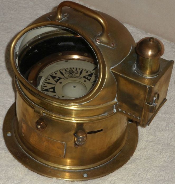
Table of Contents
Foreword
In terms of importance, navigation is way up there, something like number 3 on the list. I’d say that making sure that the “sailing machine” works is number 1; then number 2 would be everything that relates to the skipper but mainly mental health, food and water; next I’ll put navigation; finally electrical, electronics, engine and everything else line up next to the top 3 podium. I want to be able to complete the course even if my engine fails, my batteries die, my electronics are all fried, and I can’t take pictures. The only exception to this is a bunch of backup, battery powered portable devices.
In other words, to circumnavigate, I need to be able to sail, with a full stomach and without hitting anything along the way.
Let’s dummy it down
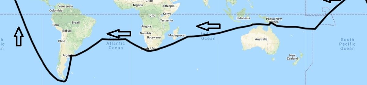
First of all, I need to know where I am, which is mostly referred to as positioning. Next, I need to know where I am going, which would be charting. Last, I need to know how to get there, taking weather into consideration, aka weather routing.

Where am I?
Historically, this was a major source of concerns, until the longitude problem was solved. There’s a wonderful book about this. Things got even easier when satellite navigation came into play, which is what most everybody relies on these days. I don’t plan to be any different since I don’t think that I’ll find the time to learn to take sights with a sextant.

Boat’s GPS
Changabang came with a dedicated GPS with a dedicated antenna (affixed to the navigation table, which may be sub-optimal, according to the manual, as it sits below the radar). I can’t say for sure but I think it dates back to when the boat was splashed, i.e. 2006. It’s an FX312 XC from M.L.R. ELECTRONIQUE, which is now discontinued (I don’t think the manufacturer is around anymore). The manual mentions something about increasing its accuracy (about 100 meters) by connecting it to the MLR DF300 Differential Beacon Receiver, or by modifying it into a FX412. I’m not sure if any of that was done. I will need to validate that when Changabang is here. This GPS may be feeding into other boat electronics such as the AIS transponder or the boat’s computer/laptop (I’ll need to verify this as well).
Now it would be nice to have that GPS integrated with an electronic chart systems so I could see the boat’s position as it relates to its surroundings. I believe this was done using Adrena and a bunch of charts, which are irrelevant to my route. I don’t think that I will set things up similarly.
Backup GPS galore
What other devices will provide me with GPS coordinates? There will be plenty but all will be dependent on recharging using the boat’s electrical systems: an Android cell phone with a GPS chip, an Android tablet with a GPS chip, a portable VHF with GPS, an Iridum GO! (or two, I still need to acquire these), a YB3 traker (if I get a subscription). Sounds like plenty to me!

I have no handheld battery powered GPS yet though, except if you consider that all the devices above combined could last me for a long time if I only use them on and off to get a position fix. So I purchased a Garmin GPSMAP 78s and a bunch of AA batteries. I will also carry a power bank to recharge USB devices in a pinch. Even if everything fails, I should still have a good fix! Well, what if the satellite network goes kaboom?!? Maybe I should pack a “Sextant quick start” box.
Where am I going?
Now that I have my coordinates it would be nice to know what’s around me. Am I going in the right direction? Am I about to hit a reef? How long is it going to take me to get to my next destination? How fast am I moving?
All of that is done using marine charts. Of which I’ll just say there are two types: paper and electronic.
Paper charts
I already bought a bunch of small scale paper charts that cover the overall course. These are very helpful to have an overall view of the possible routes and obstacles along the way. I am also adding a few larger scale charts for the South Pacific, the Torres strait area and Cape Horn. I already had charts for the US Pacific Coast.
As a very experienced navigator told me: “cartographers who decide on what is shown on small scale charts are vastly experienced, knowledgeable, and are applying centuries of cartographic know-how. They leave out details along the shore, as they have to in order keep the charts useful and not too cluttered. They NEVER leave out features that you could hit on the high seas, where there is no problem with clutter”. I received them rolled up. They’re big and to help with deploying them in a boat like Changabang I folded them flat.

Electronic charts
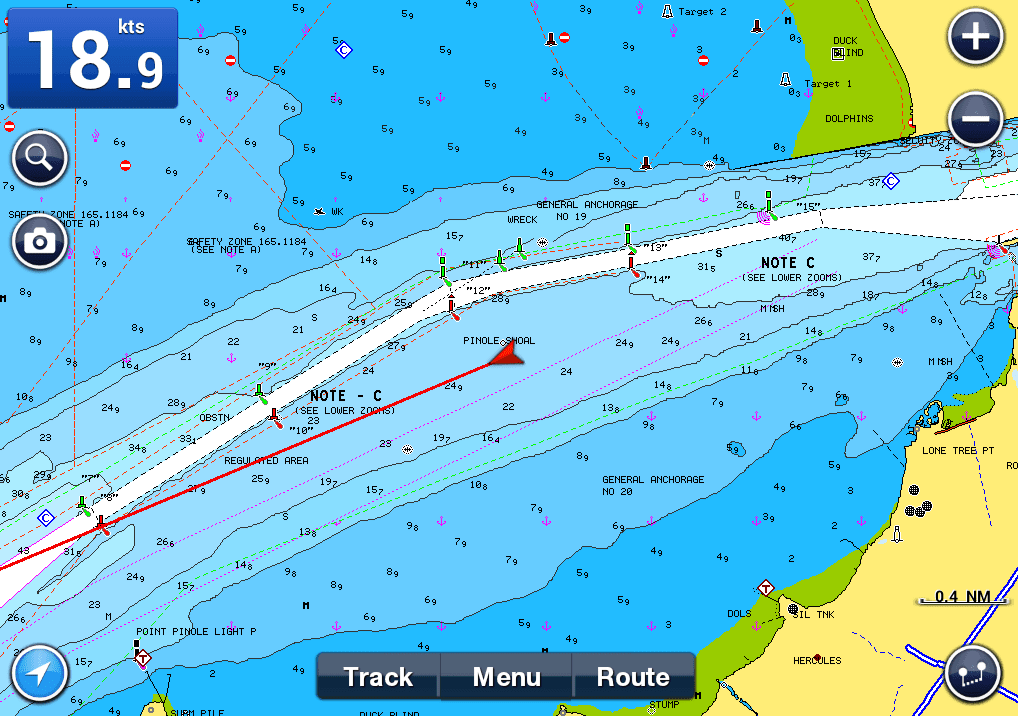
Paper charts are wonderful in that they provide an overall view of what’s going on. But they have plenty of drawbacks: they’re difficult to deploy; you have to mark your positions; it’s paper in a wet environment. This is where electronic charts shine (although electronics in a wet environment also require proper protection). With electronic charts, an integrated GPS and some software, you know where you are, where you’ve been, where you’re going, how soon you’ll get there and more. You can zoom in and out at your leisure. They are very useful but … have caused some major drama at sea when the navigator forgot to zoom in or look at small scale paper charts!
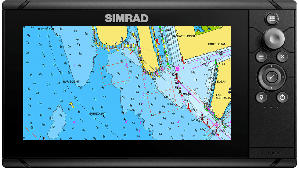
Changabang did not come with a chartplotter, besides an old laptop with outdated charts of areas where I’m not going to sail. I’ve opted for Navionics charts subscriptions to keep my cost low as I didn’t want to invest in a dedicated chartplotter. I’ll have to download charts on all my devices, which, for a circumnavigation, is a tedious process (I mean a seriously tedious process, like a couple weeks of work maybe). I may buy an additional large screen, waterproof Android tablet but for now I’ve upgraded my small phone and small/old tablet with SD cards. I’ll just have to walk the course and download charts for all my subscriptions. All in all electronic charts for this circumnavigation will cost less (much so) than paper charts.
How do I get there?
It’s all good that we know where we are and where we’re going. But we’re sailing and when we sail we depend on the wind and we want to be safe so there are at least three thing we need to know to make proper decisions about how we will get to where we’re going from where we we are. Have I lost you?
We need to know about severe weather events so we can avoid them. We need to know about wind and sea state forecasts for our area so we can best benefit from my mother Nature’s free propulsion engine. This is most commonly referred to as Weather Routing.

This is a complex matter and I’m not going to delve much into this, except to say what my choice solution is. Over the past few years I’ve used PredictWind for most of my local sailing. They proved to be very good at what they do and have excellent customer service and support.
PredictWind, their tag line says it all; “The World Leader in Wind Forecasting”. They provide an offshore app for Android (and other OS), which includes multiple models (useful for comparisons), including home grown prediction models. The offshore app (and their regular app and web site) also provides a simple way to do weather routing while at sea. I have been using PredictWind for a while now. Their services are endorsed by serious offshore race winners, so don’t just take my word for it. For this journey they offered to help defray the costs of navigation, for which I’m very grateful for. They also offer a free entry point and trials to get you started and become a better sailor.
Putting it all together
On a daily basis I plan to update weather information and routing twice, trying to line up with when the models and forecasts are being updated. In particular, there are areas where hurricanes will be of concern. The sooner I know that one is coming for me, the sooner I can devise evasive actions.
In normal conditions, once a weather route has been defined it translates into a general heading, which is passed onto the auto-pilot. The electronics on Changabang came with at least one compass from NKE. There are also two boat compasses for steering. There’s also a few handheld compasses, just in case. Hopefully that’ll be enough to help me keep a course and get back home!
Sharing my track
I am pretty confident that family, friends and supporters will want to know how I am doing, with a key question being: is he still moving? I have not decided how I will do this yet. But whatever I do I plan to show it up here.
There’s a YB3 tracker on the boat, which I could use if I buy a subscription for it. There’ll be an Iridum GO, which can also be used as a tracking device with PredictWind, or other providers.

More to come on this.
Other important things
In terms of navigation there are few other items that I would like to mention: AIS and radar. Changabang is equipped with an AIS Transponder. This communicates the boat’s position and receives other boats’ position as well, in a limited geographic area (say about 20-30 miles). I only have one of these, and a backup would be good. Changabang is also equipped with an entry level radar from Furuno.